Roof surveys · Photogrammetry · Point clouds
Every roof, from every angle.
Chartered Surveyor roof reports, CAA-licensed drone capture, photogrammetry and point cloud data — the accurate record insurers, surveyors, architects and facilities managers need. And the same clear report a homeowner gets for one roof inspection.
CAA No. 3904£1m public & employee liabilitySafeContractor approved
01 / Why drone
No scaffolding.
No cherry pickers.
Nobody at height.
A drone reaches roof slopes, gutters and elevations that would otherwise need access equipment — reducing cost, disruption and risk on the way in. The capture is CAA-licensed; the reporting is Chartered Surveyor.
-
01
Access
Roof slopes, gutters and elevations that would otherwise need scaffolding or a cherry picker — reached in a single visit, on one roof or a hundred.
-
02
Safety
The inspection happens from the air. No working at height, no access equipment standing on site, far less disruption to whoever is using the building.
-
03
Record
You keep the evidence, not just the opinion: imagery, video and measured data you can return to, re-measure and hand to a contractor later.
- 6+Years experience
- 127+Corporate clients
- 1000+Sites surveyed
02 / Key services
Four ways we capture
building intelligence.
Whether it's a single roof or a portfolio of properties, we combine Chartered Surveyor reporting with drone capture, photogrammetry and laser-accurate point cloud data.
-
01
Roof Reports
Chartered Surveyor roof condition reports and defect assessments. Clear, professional documentation for insurance, maintenance planning and Schedule of Condition.
PDF report
-
02
Drone Surveys
CAA-licensed drone roof inspections for homeowners, landlords and businesses alike. Reaching every elevation without scaffolding or cherry pickers. One roof or 100, same fast turnaround.
Imagery & video
-
03
Photogrammetry
Accurate, measurable 3D models built from overlapping aerial imagery. Ideal for planning, refurbishment and project coordination. Measure, plan and quote without returning to site.
3D model
-
04
Point Cloud Surveys
Laser-scanned digital twins that produce measurable, navigable building records for surveyors, architects and insurers. Accurate building intelligence for better decision making.
Point cloud
Brands we've worked with






03 / What you get back
From one site visit,
you can receive —
A single capture day produces far more than most clients expect. This is the list, and the file you actually get.
-
01
Roof Condition Report
The written assessment: condition, defects, recommendations and photographs, signed off by a Chartered Surveyor.
PDF
-
02
Orthomosaic Map
Every roof slope stitched flat into one image, to scale, measurable from end to end.
GeoTIFF
-
03
Photogrammetry Model
The building as a model you can orbit, measure and quote from — without going back to site.
OBJ
-
04
Point Cloud File
The raw survey-grade record — a dense set of millions of precisely measured points.
LAS / E57
-
05
360° Virtual Tour
Walk the site from a desk, with anyone who needs to see it — insurer, adjuster, contractor.
Web link
-
06
Measured Floor Plan
Internal layouts to scale, taken from the same visit and the same scan data.
PDF / DWG
04 / How it works
From enquiry
to delivered data.
Five steps, no surprises. You will know the scope, the price and the deliverable before anyone leaves the ground.
-
01
Tell us about the site
Property type, size and what you need to know. No obligation — just clarity on scope.
-
02
Fixed, fast quote
A tailored quote based on access, site conditions and the deliverables you need.
-
03
Site visit
Our CAA-licensed pilots and surveyors capture the site — no scaffolding required.
-
04
Process & model
Imagery and scan data are processed into reports, models or point cloud datasets.
-
05
Deliver & support
You receive clear, actionable documentation — with support interpreting the findings.
05 / Our work
Real projects,
real outcomes.
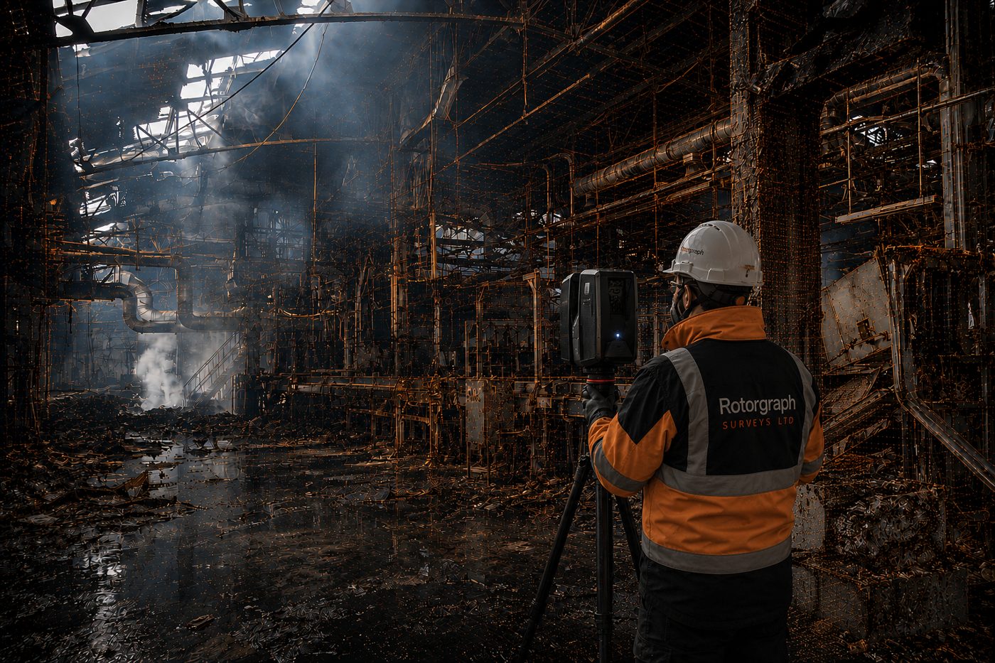
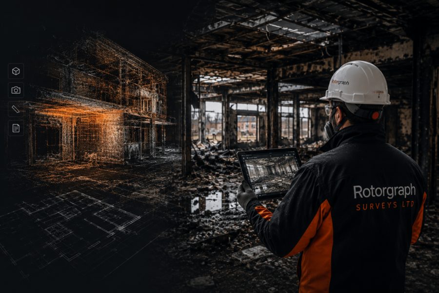
Fire, flood and escape of water are a significant part of the work — capturing damage as measurable data so insurers and loss adjusters can settle without everyone standing in the wreckage.
-
01
Major Industrial Fire
Digital Twin & Point Cloud Industrial property -
02
Kings Hall Church, Southall
Fire Survey, Digital Twin & Point Cloud Heritage -
03
Wakefield Academy School
Annual Roof Inspection Programme Education
06 / What clients say
I have been working with Gary and the Rotorgraph team for around five years, preparing roof inspection reports and undertaking other surveying-related work. The drone images, videos and models that Gary provides are excellent and help me to prepare accurate reports.
-
“The quality of the 3D imagery was excellent, which helped me to communicate the extent of damage to stakeholders, without them having to visit site.”
-
“Professional, fast, quality of work is outstanding!”
07 / Get in touch
Tell us about
the site.
We'll come back with a tailored approach and a fast, transparent quote. No job too small.
Get a fast, free quote- Call
- 01274 046190
- Mobile
- 07738 276411
- Studio
- Rotorgraph House, 15 West Dean Close,
Queensbury, Bradford BD13 2GH